Imagine leaving your dock and dropping anchor over clear reef in under half an hour. In Key Largo, that can be your normal weekend, but only if your home or marina choice fits how you like to boat. If you are weighing neighborhoods, slips, or storage options, understanding marinas, launches, and run times will help you buy with confidence. This guide walks you through access types, practical timing, and what to verify so your boating matches your lifestyle. Let’s dive in.
Key Largo boating at a glance
Key Largo sits beside some of Florida’s most accessible coral reefs and protected waters. John Pennekamp Coral Reef State Park manages popular snorkeling and diving access with designated mooring buoys and visitor facilities. The Florida Keys National Marine Sanctuary overlays most offshore waters and sets rules that protect coral and seagrass while guiding where you anchor and how you operate.
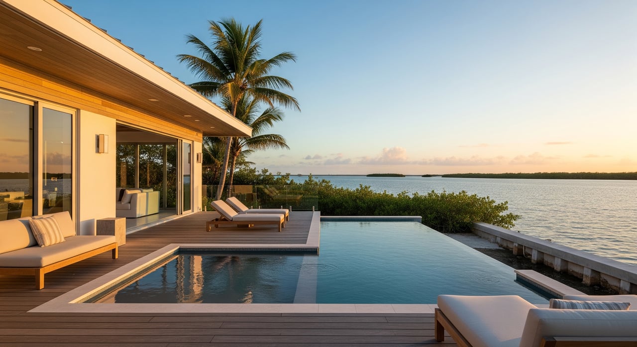
You also have choices beyond the reef. On the bay side, you will find flats, mangroves, and calmer backcountry routes that are great for fishing and family cruising. Your ideal home base depends on whether you prefer quick ocean runs to the reef or quieter days on the bay.
Launch and marina options
State park and public ramps
Day users and visitors often launch at John Pennekamp Coral Reef State Park, which offers visitor services, designated mooring buoys, and park-operated boarding areas for small craft. Monroe County also maintains public ramps across the Keys. Always check current hours, parking rules, and capacity before you go during high season.
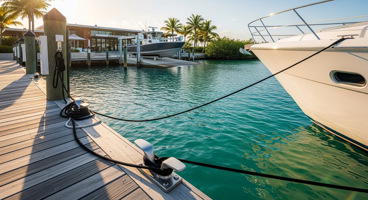
Private and commercial marinas
Private marinas in Key Largo typically offer fuel, pump-out, transient slips, power, repairs, and security. These are ideal if you want regular slip access and full-service maintenance. One example of a high-amenity private environment is Ocean Reef Club in northern Key Largo, a gated community with its own marina and services.
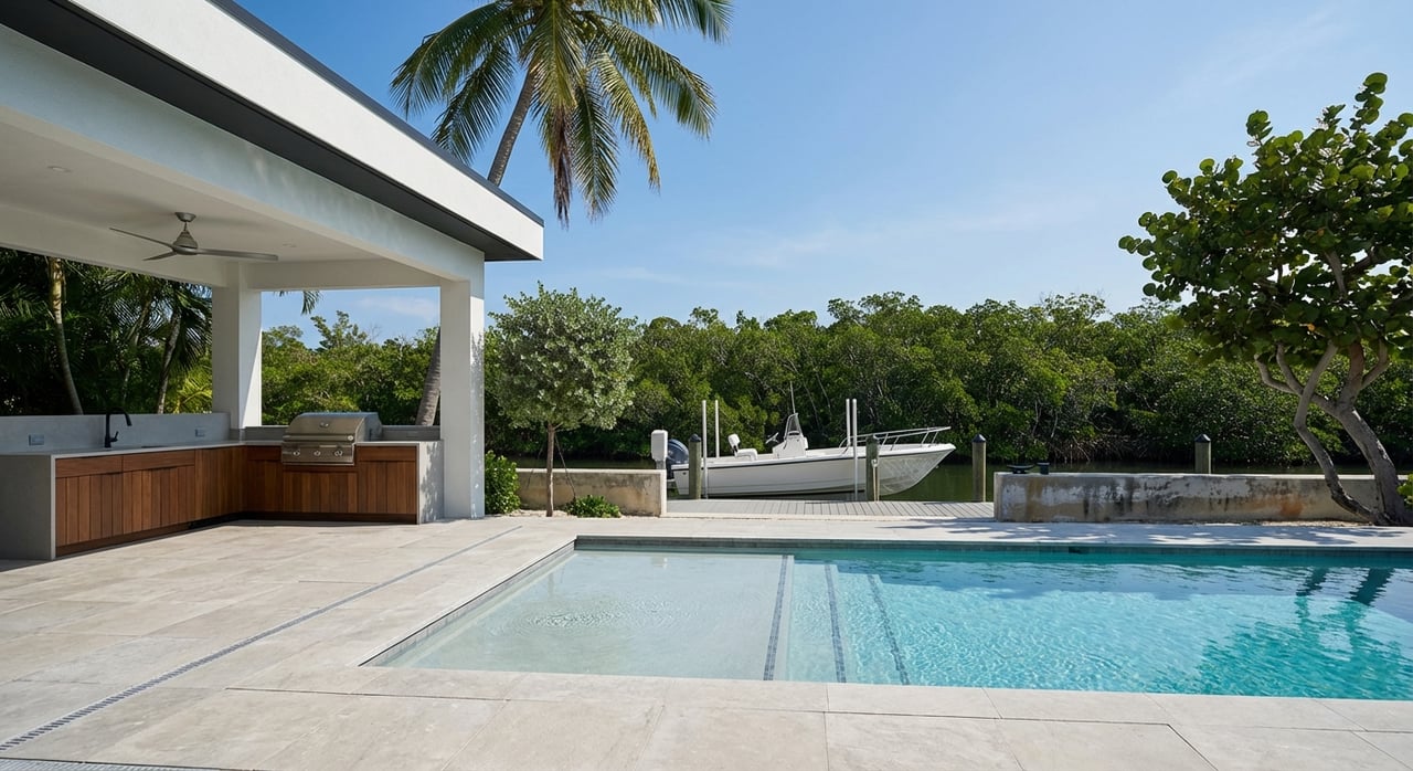
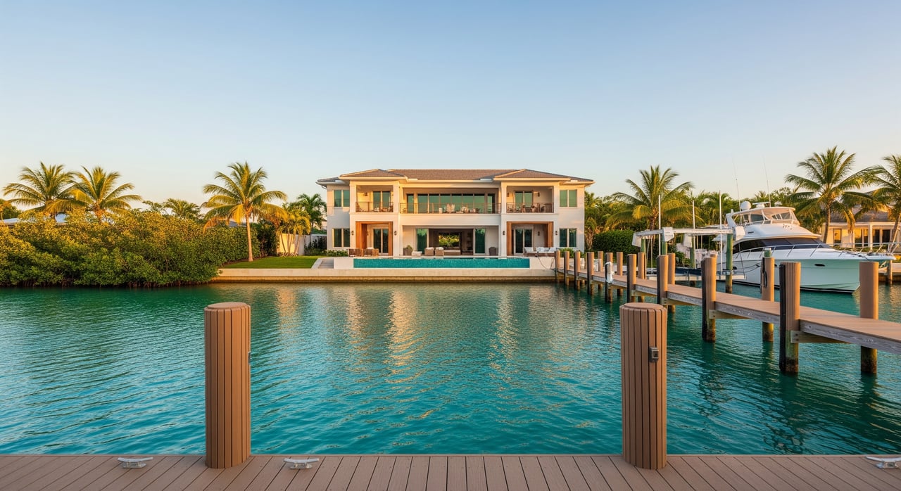
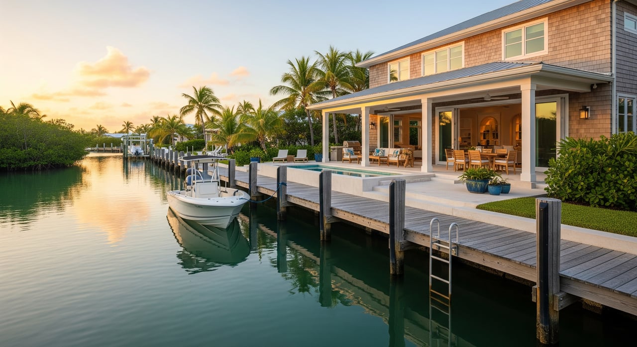
Residential docks and community marinas
Many canal-front and oceanfront neighborhoods include private docks or shared community marinas. Dock permits and construction standards vary by parcel, HOA, and county, so verification is essential. Dry-stack and large storage yards are less common in Key Largo due to limited land, though nearby areas may offer additional storage options.
Charters and rentals
If you plan to boat occasionally, Key Largo’s charter and rental operators make it easy to reach reefs, wrecks, and sandbars without owning a vessel. This is a smart bridge option while you search for a home with the right dock or slip.
What to check before you dock
Before you commit to a slip, marina, or property, confirm:
- Slip size, maximum LOA and beam, and depth at mean low water.
- Fuel availability, power service (amps and voltage), and pump-out access.
- Haul-out and repair options, security, and insurance requirements.
- Dockage rates, liveaboard policies, and transient or seasonal rules.
- Hurricane season protocols, including haul-out requirements and fees.
How long to reefs and sandbars
Transit time comes down to distance and speed. Use the simple formula: time in hours = nautical miles divided by speed in knots, then multiply by 60 for minutes. Add a reasonable buffer for channel routing and busy days, especially during winter season.
Quick time converter
- At 10 knots: 1 nm is about 6 minutes, 3 nm about 18 minutes, 5 nm about 30 minutes.
- At 20 knots: 1 nm about 3 minutes, 3 nm about 9 minutes, 5 nm about 15 minutes.
- At 30 knots: 1 nm about 2 minutes, 3 nm about 6 minutes, 5 nm about 10 minutes.
Practical ranges from Key Largo
- Nearshore snorkel and dive sites managed through John Pennekamp and sanctuary buoys are roughly 1 to 5 nautical miles off many oceanfront docks. Expect about 5 to 30 minutes, depending on speed and exact slip location.
- Main nearshore reefs along the reef tract are often 3 to 10 nautical miles away. Plan for about 10 to 60 minutes, depending on boat and conditions.
- Sandbars and shallow recreation areas are commonly within 10 to 30 minutes from many Key Largo launch points, though some popular gathering spots can take longer.
- Backcountry flats and bay fishing grounds are often under 30 minutes from bay-side launches, with deeper Florida Bay or offshore edges taking longer.
Plan your route
- Identify your marina or dock location and your target site.
- Measure nautical miles on updated charts, then divide by your normal cruising speed.
- Add 10 to 30 percent for channel navigation, slow approaches, and traffic.
- Adjust for sea state. Atlantic reef runs can be bumpy on windy days, which slows smaller boats.
Neighborhood fit by boating style
Your daily boating rhythm shapes the right location.
- If fast reef access is the priority, oceanfront homes or Atlantic-side slips minimize transit times to buoys and dive sites. Expect more exposure to wind and swell and higher construction standards for docks.
- If calmer, protected cruising and flats fishing are your focus, canal or bay-side properties offer a quieter experience. Verify canal depths and turning basins if you plan to keep a larger boat.
- If you prefer turnkey convenience with on-site services, private communities with robust marina infrastructure are attractive, with membership and premium costs to consider.
Permits, depth, and rules to confirm
Before you buy, verify the details that determine what boat you can keep and how often you can use it:
- Dock permits and status. Confirm whether the dock is permitted, grandfathered, or needs new approvals at the county and state levels.
- Water depth at low tide. Check for draft limits at the slip and along the access channel.
- Bridge or channel constraints. While Key Largo has open Atlantic access, confirm clearances if you plan to move north or south to other keys.
- HOA and community rules. Review slip assignment processes, guest docking, liveaboard policies, and any charter restrictions.
- Insurance and hurricane plans. Many marinas and insurers require defined storm protocols, haul-out plans, or specific tie-down methods.
Seasonal and safety notes
- Expect more traffic in peak season, which can extend time to find mooring buoys or anchorage and lengthen your approach to popular sites.
- Follow no-wake and speed zones, and use mooring buoys where provided to protect coral.
- Plan with updated weather, tides, and charts, and have a backup site if moorings are full.
- Keep pump-out and discharge rules in mind. Many marinas provide or require pump-out services.
Your next step
Choosing the right dock, canal, or marina can add hours of enjoyment to every boating day. If you want a home that matches your boating habits, local knowledge matters. The Sally Stribling Luxury Group lives and works on the water here, and we help you evaluate depth, permits, and everyday convenience so your Keys home delivers the lifestyle you expect.
Ready to align your boating with the right Key Largo property? Connect with the Sally Stribling Luxury Group.
FAQs
What marina and launch options exist in Key Largo?
- You can choose from state park access at John Pennekamp, Monroe County public ramps, private full-service marinas with fuel and repairs, and residential docks or community marinas in canal and oceanfront neighborhoods.
How fast can I reach Key Largo reefs from an oceanfront slip?
- Many nearshore sites are roughly 1 to 5 nautical miles offshore, so plan about 5 to 30 minutes depending on cruising speed, exact dock location, sea state, and traffic.
What should I verify about a home’s dock before buying?
- Confirm permits, depth at mean low water, slip dimensions, access channel constraints, power and water, pump-out access, HOA rules, and hurricane protocols required by marinas or insurers.
How do ocean and bay access differ for daily boating?
- Ocean access offers the quickest reef runs with more exposure to wind and swell, while bay and canal access provide calmer water suited to flats fishing and family cruising but may impose depth or draft limits.
Are there anchoring rules near Key Largo’s reefs?
- Yes. In sanctuary and state park areas, anchoring on or near coral is restricted, and you should use designated mooring buoys where provided to prevent reef damage.
When is boat traffic heaviest around popular sites?
- Winter tourist season and weekends typically bring more boaters to reefs and sandbars, which can increase approach times and reduce mooring availability; plan earlier departures or alternate sites.