Buying Waterfront in Plantation Key: A Starter Guide
January 1, 2026
January 1, 2026
Picture stepping from your back deck onto your boat, coffee in hand, with clear turquoise water stretching toward the horizon. If you’re exploring waterfront homes in Plantation Key for the first time, you might be weighing ocean thrills against calm bay sunsets and trying to make sense of docks, canals, permits, and insurance. This guide breaks down the practical choices that shape your lifestyle and long-term costs so you can buy with confidence. Let’s dive in.
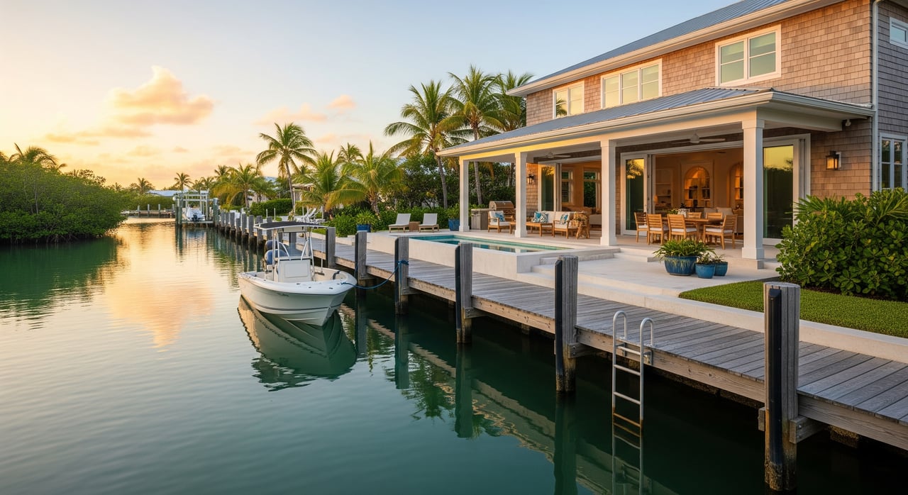
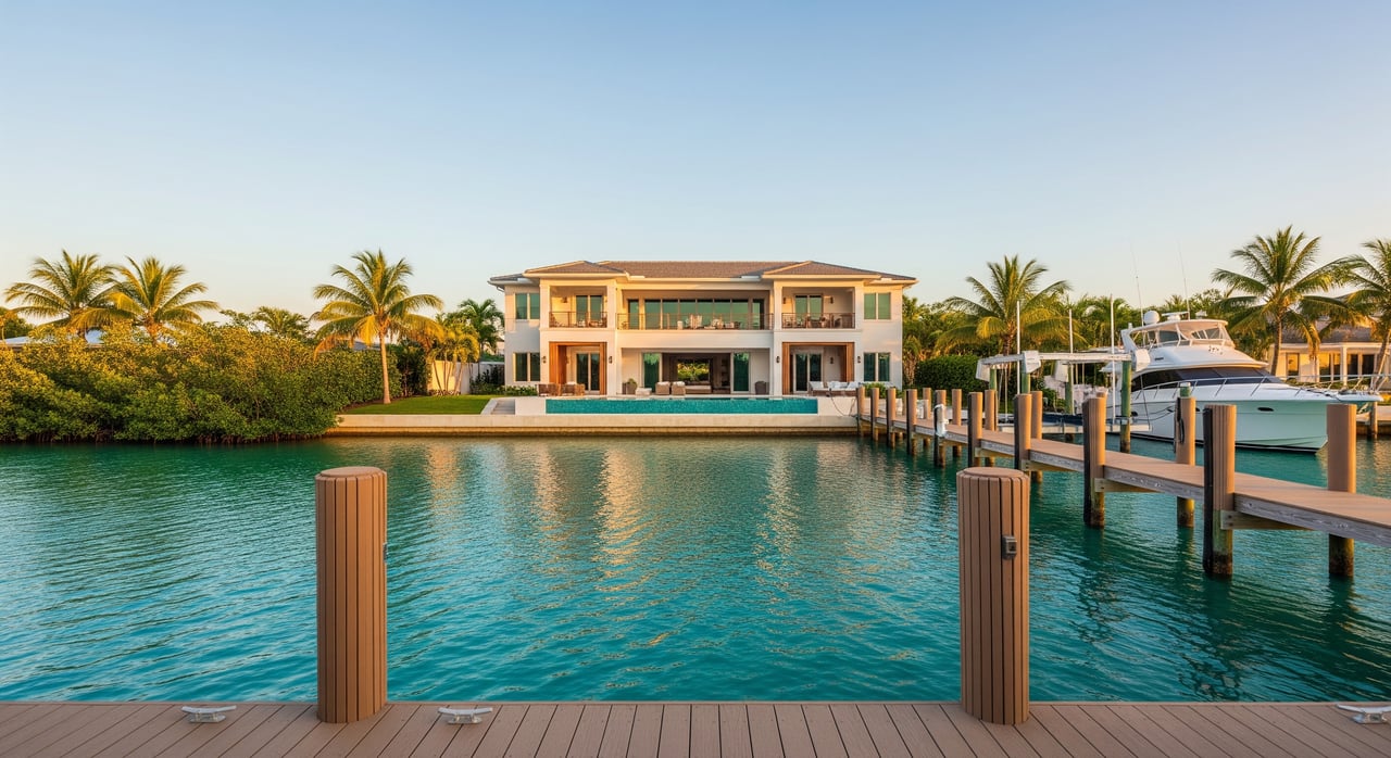
Plantation Key sits in the Middle Keys in Monroe County along U.S. 1, with waterfront that faces either the Atlantic side near Hawk Channel or the more sheltered bay and mangrove side. Many homes front dredged saltwater canals that connect to larger channels.
Water access varies block by block. Some canals are deep and wide enough for larger center consoles and small yachts. Others are narrow or shallow and are better for skiffs and flats boats. Those details impact boating ease, maintenance, insurance, and resale value just as much as the home itself.
Ocean access gives you a quicker run to deep water for offshore fishing and diving. It typically means deeper water and fewer grounding risks for moderate draft boats. The trade-off is more exposure to wind and wave action, greater surge during storms, and potentially higher insurance costs.
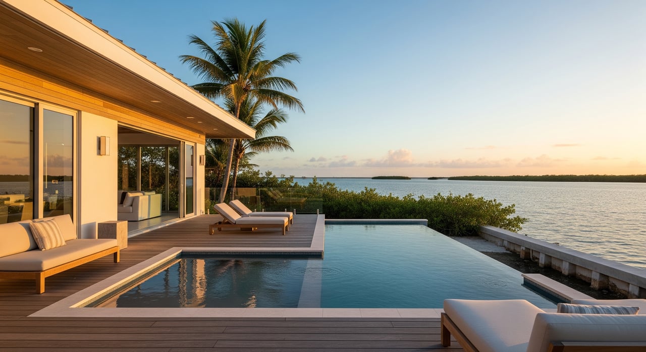
Bay and canal settings are calmer, especially in the evenings, which can make docking and day-to-day boating feel easier. Water is often shallower with seagrass or soft bottoms, and runs to offshore water can be longer. If your priority is protected water and wildlife viewing, bay-side living can be a great match.
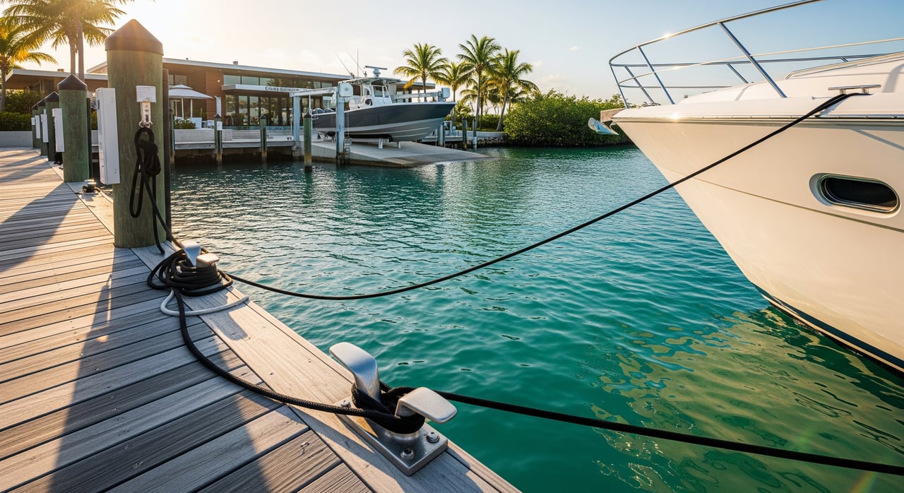
The size of the boat you can keep at home starts with canal depth and width. Ask for measured depth at Mean Low Water, not just a chart reading. Depths can shift after storms or dredging nearby, so current measurements matter.
If your route to open water passes under fixed bridges, vertical clearance at Mean High Water determines whether a tower or mast will fit. Verify clearances for each bridge on your path using official publications or charts. A simple oversight here can limit the boats you can own.
Use official nautical charts and local aids to navigation when planning routes. The Florida Keys have a relatively small tidal range, but low water still affects shallow spots and clearances. Know local no-wake zones, marked channels, and any dredged routes you’ll rely on.
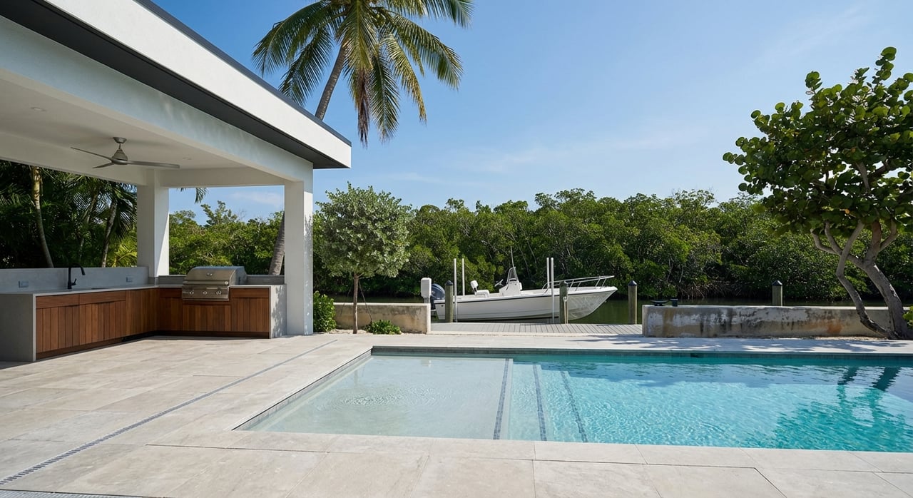
Seawalls and bulkheads are common along canals. Their condition, permitting, and age drive long-term costs. In saltwater, docks and lifts wear quickly and need marine-grade materials, proper piles, and corrosion protection.
Lifts and lighting require safe, adequately sized shore power. Confirm the electric capacity, the condition of wiring, and that any waterside service is properly protected. Water service can be a convenience but still needs appropriate materials and installation.
Waterfront work often involves multiple agencies. Expect to interact with Monroe County Building and Permitting for docks, lifts, and seawalls. Depending on the scope and location, the Florida Department of Environmental Protection, the Florida Bureau of Submerged Lands, and the U.S. Army Corps of Engineers may also be involved.
Seagrass and coral habitats are protected in the Keys. Anchoring on seagrass, dredging, and altering shorelines face strict rules, including within the Florida Keys National Marine Sanctuary. Mangroves are protected under state law. Trimming or removal typically requires approval and may require mitigation.
Florida uses the Mean High Water line to establish boundaries along tidal waters. Verify what your deed grants along the water, including dock rights, bulkhead ownership, and mooring permissions. A current survey showing the Mean High Water line and any easements is essential.
Keys properties sit in FEMA flood zones. Elevation and construction standards matter for safety and insurability. Factor both flood insurance and windstorm coverage into your budget early, including hurricane deductibles. After major storms, rebuilding is governed by local code and may trigger elevation and coastal standards.
Confirm whether the property is connected to Monroe County Utilities or still uses a septic system. Small lots and canal-front parcels can face restrictions on septic systems. Records, permits, and any required inspections should be part of your review.
Start with your boating profile. If offshore runs are your priority, focus on ocean-side access and deeper canals. If you want sheltered evenings and simpler docking, look at bay-side or protected canals. Match the canal, depth, and bridge profile to the boat you own or plan to buy.
On each tour, document the five vital items before making claims or decisions: dock depth at MLW, boat lift capacity and permit status, canal maintenance responsibility, flood zone and elevation certificate status, and any easements or submerged land leases. If water access is a key reason you’re buying, consider hiring a local marine surveyor or coastal engineer to inspect the dock, lift, and seawall before you finalize terms.
Finally, verify insurance quotes early. Flood and wind premiums can meaningfully change affordability and may influence which properties you pursue. A clear-eyed approach to water access, permits, and insurance will set you up for a confident purchase in Plantation Key.
Ready to explore the best-fit waterfront for your lifestyle? Connect with the local team that blends decades of Keys expertise with global marketing reach through the Coldwell Banker Global Luxury network. Reach out to the Sally Stribling Luxury Group to start your search.
Stay up to date on the latest real estate trends.
We pride ourselves in providing personalized solutions that bring our clients closer to their dream properties and enhance their long-term wealth. Contact us today to find out how we can be of assistance to you!